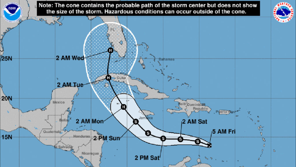
Tropical depression nine has formed overnight as forecasters predict a potential impact for Florida next week as it moves into the Gulf of Mexico. The National Hurricane Center (NHC) said environmental conditions favor further strengthening.
There are five storm systems in the Atlantic right now, which is typical this time of year. Most hurricanes have hit Florida during September and October.
The tropical depression is located about 1,000 miles east of Cuba, moving at 13 mph with maximum sustained winds of 35 mph. A turn to the west-northwest and northwest is expected this weekend.
The tracking models show the depression strengthening into a hurricane sometime next week as it approaches Florida. There’s still a lot of uncertainty, but it’s likely to make landfall on the west coast or central Florida. Forecasters say it could become a Category 2 with maximum sustained winds of 110 mph.
As for Sebastian, the storm is not expected to become a major hurricane for our area. However, we could experience high winds, rains, flooding, and the threat of tornadoes.
Sebastian Daily will keep you updated on any threats to our local area.
