Hurricane Dorian is now a Category 4 hurricane with winds of 130 mph. The current tracking of Dorian has changed, and it could miss Florida altogether.
However, residents in Grant, Barefoot Bay, Micco, Sebastian Fellsmere, and Vero Beach should still prepare for this storm.
Please make sure you have plenty of water, food, and medication to last seven days. Board up any windows and listen to the advice given by emergency officials.
Earlier today, we told you that Dorian was more likely to make landfall near West Palm Beach. The hurricane would then make a slow turn to the north and move up the state of Florida.
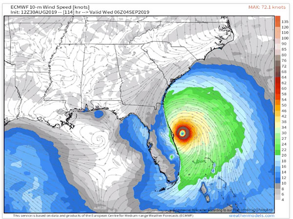
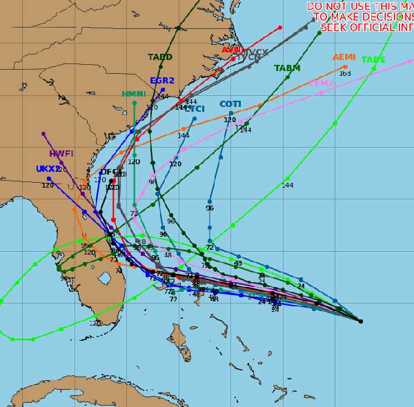
During the afternoon, we watched the EURO, and DFS computer models make a shift to the east. These hurricane models are not the official forecast, but we were surprised by the sudden change within four hours from west to east.
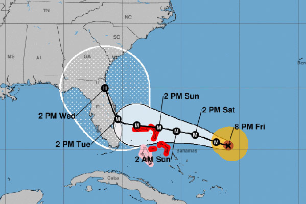
Then, at 5:00 p.m., the National Hurricane Center updated its path to reflect these two models. They shifted the cone of uncertainty from west to east.
At 8:00 p.m., the National Hurricane Center updated its path again with it heading east.

When we watch the EURO model, it comes close to Florida before turning north and remaining out to sea. When we watch the DFS model, it shifted to the east but is riding the coastline. The DFS model would be devastating to our area if it took this path. However, EURO has been a little more accurate in its tracking. Please remember that this is not an official forecast.
Hurricane Dorian is about 575 miles of West Palm Beach, Florida. The hurricane is moving west-northwest at 10 mph with maximum sustained winds of 125 mph.

Hurricane Watches are expected to be issued this weekend. Brevard County is already calling for a mandatory evacuation this weekend. Please listen to local officials for more information.
For now, all we can do is wait. We will have more information on Saturday. Until then, please remain calm.
Stay tuned for more updates. We will be LIVE on our SebastianDaily.com website, Facebook, and YouTube all weekend at various times.


