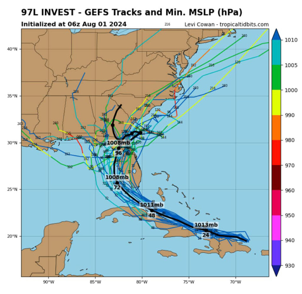
There’s a 60% chance a tropical depression could form near Florida’s west coast by early next week, according to the National Hurricane Center.
According to forecasters, A tropical wave is moving west-northwest through the Caribbean. While Sebastian faces no immediate threat, residents can expect much-needed rainfall.
A tropical wave is essentially a disturbance or trough of low pressure in the atmosphere that moves from east to west across the tropics. It’s often depicted as a wavy line on weather maps.
While not a storm itself, a tropical wave can be a precursor to tropical development. If conditions are favorable, such as warm ocean waters and low wind shear, a tropical wave can intensify into a tropical depression and eventually a tropical storm or hurricane.
The system is currently producing disorganized showers and thunderstorms over Hispaniola, Puerto Rico, and the Virgin Islands. Forecasters predict slow development over the next few days as the wave moves west-northwestward through the Greater Antilles.
“Environmental conditions are forecast to be more conducive for development after the wave passes the Greater Antilles, and a tropical depression could form this weekend or early next week over the eastern Gulf of Mexico or near the Florida Peninsula,” the National Hurricane Center said.
Weather Models

The latest models indicate a potential track toward west Florida, with both the EURO and GFS models supporting this path.
A tropical depression is the earliest stage of a tropical cyclone. It’s characterized by a low-pressure area with organized thunderstorms that are producing sustained winds of less than 39 miles per hour (34 knots).
Essentially, it’s a developing storm system that hasn’t yet reached the intensity of a tropical storm. If conditions remain favorable, a tropical depression can strengthen into a tropical storm.
Sebastian Daily will continue to provide updates as the situation develops.


