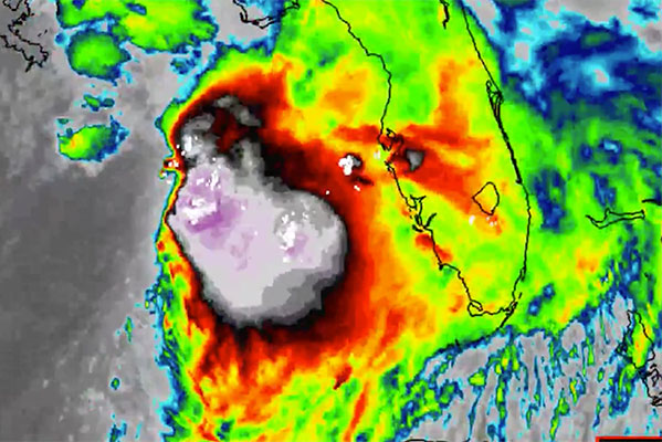
Tropical Storm Nestor was named late this afternoon in the Gulf of Mexico by the National Weather Service. Nestor is expected to move into Florida’s west coast and Georgia this weekend.
The radar and computer-generated models of Nestor show no threat to Sebastian, Grant, Barefoot Bay, or Micco. The tropical storm will continue to move northeast and into Georgia and South Carolina.
However, Nestor will change our weather, and we already see a shift in the wind tonight. Clouds from the storm will produce thunderstorms tonight and through Saturday.
The National Hurricane Center also echoed our findings in its latest forecast.
“It would not be surprising to see Nestor take on a more subtropical appearance overnight, as the GFS and ECMWF show the upper trough becoming superimposed on the low-level circulation, with the pressure continuing to deepen and some increase in the peak winds noted in both those models,” the National Hurricane Center said.
The good news is that Tropical Storm Nestor is a fast-moving storm, and it should clear up by Sunday morning. He will give us one day of bad weather before moving into Georgia and South Carolina.


