Hurricane season continues in full force until November 30th, underscoring our location in the hurricane-vulnerable Sebastian, Florida.
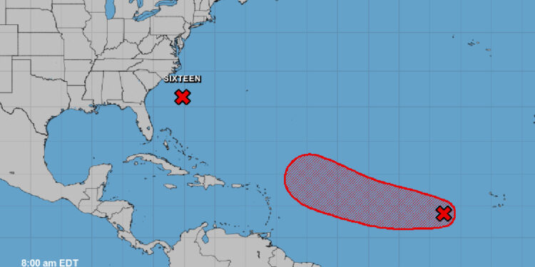
Three tropical disturbances stir the Atlantic, one setting its course for the Caribbean. Florida isn’t directly in its path; however, it’s too early for conclusive projections.
We’ve analyzed various weather models, and the GFS and EURO models indicate a curve back into the ocean, veering away from Florida. The models show the same consistency with a trend we’ve noted repeatedly this season.
We anticipate a more detailed forecast from NOAA in the coming days.
The tropical wave is producing rainfall and thunderstorm activity, primarily about 600 miles west-southwest from the Cabo Verde Islands.
The National Hurricane Center (NHC) remarked, “Further development is expected, and a tropical depression is likely to form during the next couple of days while the system moves generally westward at 10 to 15 mph. The system is then expected to turn west-northwestward early next week as it moves over the central tropical Atlantic.”
The probability of this system turning into a more organized formation during the next seven days stands at 90 percent.
Sebastian Daily remains committed to keeping you updated on these developments.


